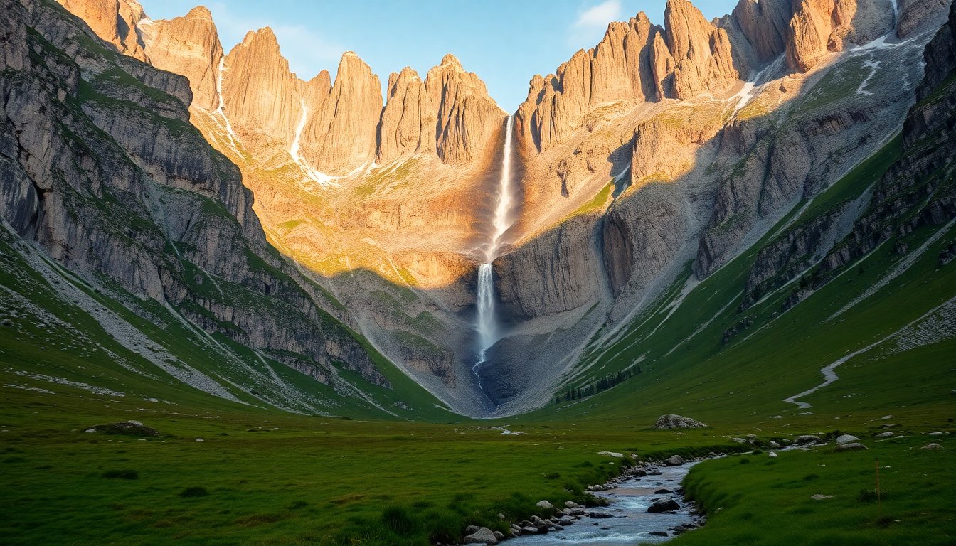
Some landscapes you have seen a hundred times in photographs, and then you stand in front of them and everything resets. The Cirque de Gavarnie is one of those. You leave the village, the path follows the mountain stream, and suddenly the valley closes into a limestone wall over 1,500 metres high, stacked in three tiers and streaked with waterfalls. Victor Hugo called it a colosseum of nature. He was barely exaggerating.
This guide covers what actually matters: how to get there, which hike suits your level, what the cirque is really like in winter, and how to avoid sharing it with three thousand other people in mid-August.
What the Cirque de Gavarnie actually is
The cirque is a glacial amphitheatre carved into limestone at the head of the Gavarnie valley, in the Hautes-Pyrénées. Its walls rise around 1,500 metres above the floor, in three successive tiers. The Spanish border runs along the crest above, at over 3,000 metres.
Its signature is the Grande Cascade: a drop of roughly 422 metres, the highest waterfall in France. It is fed by snowmelt on the Spanish side, which is why it is thunderous in June and can shrink to a thread by the end of a dry summer.
The site has been a UNESCO World Heritage property since 1997, as part of the cross-border “Pyrénées – Mont Perdu” listing shared with Spain. It also lies inside the Pyrenees National Park, which has very concrete consequences for what you are allowed to do (see below).
The village of Gavarnie itself sits at around 1,365 metres. It is a tiny mountain village living off tourism and pastoralism, and it is the base camp for everything that follows.
Driving to the Cirque de Gavarnie
Access is via the D921 from Luz-Saint-Sauveur, which connects to Lourdes and Argelès-Gazost. The road is beautiful, winding, and ends in a dead end at Gavarnie: there is no through route, you drive up and drive back down.
Allow about an hour from Lourdes, a little more from Tarbes. The nearest airports are Tarbes-Lourdes and Pau; Toulouse is roughly two and a half hours away.
The village has car parks, which charge in season. The important thing is not the price, it is what time you arrive. In July and August the car parks fill by mid-morning and the queue at the village entrance becomes genuinely tiresome. Arriving before 9 am changes the entire day. Arriving after 11 am means walking the trail in a continuous stream of people.
There is no road to the foot of the cirque. From the village it is on foot, on horseback or by donkey — local operators offer the latter two, which is a sound solution with small children or for anyone who walks with difficulty.
The classic hike: village to the Grande Cascade
This is the Gavarnie walk, the one the overwhelming majority of visitors do, and it is within almost everyone’s reach.
- Start: Gavarnie village (~1,365 m)
- Finish: the Hôtellerie du Cirque, at the foot of the walls (~1,570 m)
- Distance: about 3 km each way
- Ascent: about 250 m
- Time: 1 hour to 1 hour 15 up, slightly less down
- Difficulty: easy, on a wide, well-made path
The trail follows the stream, crosses meadows, then climbs gently among boulders. You walk facing the cirque the whole way, which makes the ascent genuinely enjoyable: the backdrop grows as you go.
The Hôtellerie du Cirque marks the end of the easy path, and it is from here that the view of the Grande Cascade is truest. Confident walkers can continue a little further over rougher ground to get closer to the base of the falls — the terrain becomes markedly stonier and slippery in the wet.
The one tip worth taking: do this early in the morning. The light is better, the waterfall is fuller (the night’s meltwater arrives mid-morning), and you will meet a fraction of the crowd.
The more demanding routes
The Brèche de Roland (2,804 m)
This is the legendary objective: a notch forty metres wide and a hundred metres high, cut clean through the border ridge, which legend attributes to a blow from Roland’s sword at Roncesvalles.
You reach it not from the village but from the Col des Tentes (2,208 m), at the end of a road climbing above Gavarnie which is closed in winter. From there you reach the Sarradets refuge (2,587 m), then the gap itself.
This is a genuine mountain outing, not a stroll. A steep snowfield persists just below the breach for most of the year: crampons and an ice axe are regularly necessary, even in high summer. If you are not equipped and comfortable on that ground, hire a guide. Walkers get caught out here every year.
From the breach, the Taillon (3,144 m) is the most accessible 3,000er in the area for a fit mountain walker.
The Pimené (2,801 m)
Far less busy, and yet it is the best viewpoint over the cirque. You climb the facing slope, which lets you take in the whole amphitheatre in a single sweep, with Mont Perdu behind. Allow a long day and around 1,400 metres of ascent from the village: physically demanding, but technically straightforward.
The GR10
The GR10, the long-distance traverse of the Pyrenees from Hendaye to Banyuls, passes through Gavarnie. If you are on a multi-day walk, the village is a natural stage and a good resupply point.
The Cirque de Gavarnie in winter
This is the question we are asked most, and the answer is: yes, it is worth it — but it is a different outing entirely.
The village stays accessible by car all year (the D921 is cleared). The Col des Tentes road, however, is closed, which puts the Brèche de Roland out of reach for the ordinary walker.
The cirque path itself can be walked on snowshoes when there is snow. In winter the cirque is quieter, more austere, and the Grande Cascade partly turns into a column of ice — the site is well known to ice climbers.
One warning, and it is not a formality: the floor of the cirque is an avalanche path. After heavy snowfall, or during a thaw, the trail can be exposed. Check the avalanche bulletin before you go, and do not hesitate to turn back.
When to go
- June: the waterfall is at its most powerful, the meadows are in flower, and it is still quiet. Probably the best compromise.
- July–August: everything is open and running, but it is busy. Simply start early.
- September–October: superb light, crowds gone, though the waterfall is often thin after a dry summer.
- Winter: a radically different atmosphere, on snowshoes, with the caution that requires.
What you may not do (National Park rules)
The cirque lies in the core zone of the Pyrenees National Park. In practice:
- Dogs are banned, even on a lead. This is not negotiable and it is enforced.
- Picking plants, fires and camping are prohibited. Wild camping (bivouac) follows a specific rule — a minimum distance from road access, and evening-to-morning only. Check with the Park visitor centre before relying on it.
- Drones are prohibited.
There is a reason for all this: the site holds izards (Pyrenean chamois), marmots, and a population of griffon vultures that you will regularly see wheeling above the walls. Bring binoculars.
Where to stay
Gavarnie village has hotels, guesthouses and refuges, in limited numbers — book early for July or August. Staying overnight is the surest way to be on the trail at dawn.
If everything is full, Gèdre, Luz-Saint-Sauveur and Argelès-Gazost offer far more choice twenty to forty minutes away, with the advantage of putting the whole valley within reach.
The Hôtellerie du Cirque, at the end of the trail, is a place apart: a hot chocolate there, facing the walls, is part of the ritual.
Nearby
Do not leave without seeing the valley’s two other cirques, both far quieter:
- The Cirque de Troumouse, wider and more open, reached by a road that climbs very high (toll in season). The sense of space is startling.
- The Cirque d’Estaubé, more secretive, earned on foot from the Gloriettes dam.
An hour away, Cauterets and the Pont d’Espagne open onto another world: the Lac de Gaube and the Vignemale. And if snow is your thing, our guide to snow in the Pyrenees will help you pick the right week.
Frequently asked questions
How high is the Cirque de Gavarnie? The village sits at about 1,365 m, the foot of the cirque at about 1,570 m, and the walls top out above 3,000 m on the border ridge.
How long should I allow? For the classic walk to the Grande Cascade, 2.5 to 3 hours round trip including stops. With the drive and parking, allow half a day.
Can I do it with children? Yes. The path to the Hôtellerie is wide and even. Five- and six-year-olds manage it, and donkey or horseback options exist for the smallest.
Can you get close to the Grande Cascade? You can get considerably closer than the Hôtellerie, but the ground turns stony and slippery. The foot of the falls itself is for experienced walkers.
What about prices and opening times? Car parks, shuttles, horse and donkey operators and refuges all change their rates each season. Check with the Gavarnie tourist office before you travel.